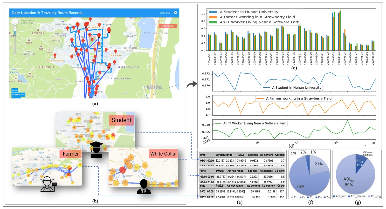
EnvironMax integrates multi-source, real-time spatial data to compute where environmental health risk is highest and to route people around it. Dynamic risk models translate raw sensor and trajectory data into guidance a resident can act on.
The work produced sustained, high-impact research: a paper in Urban Climate (Q1, IF 6.4) and earlier work in Science of the Total Environment (Q1, IF 9.8), one of the most cited venues in environmental science.
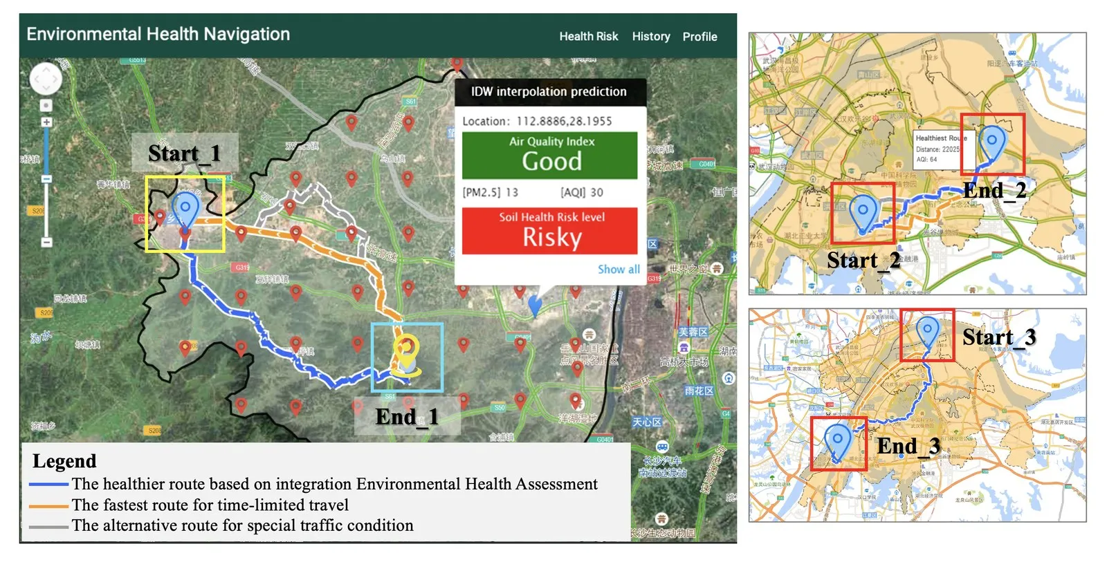
Health-aware route guidance that steers residents around environmental hazards.