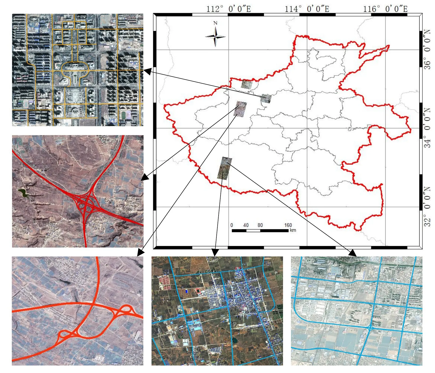
Geographic coverage of the dataset over high-resolution satellite imagery.
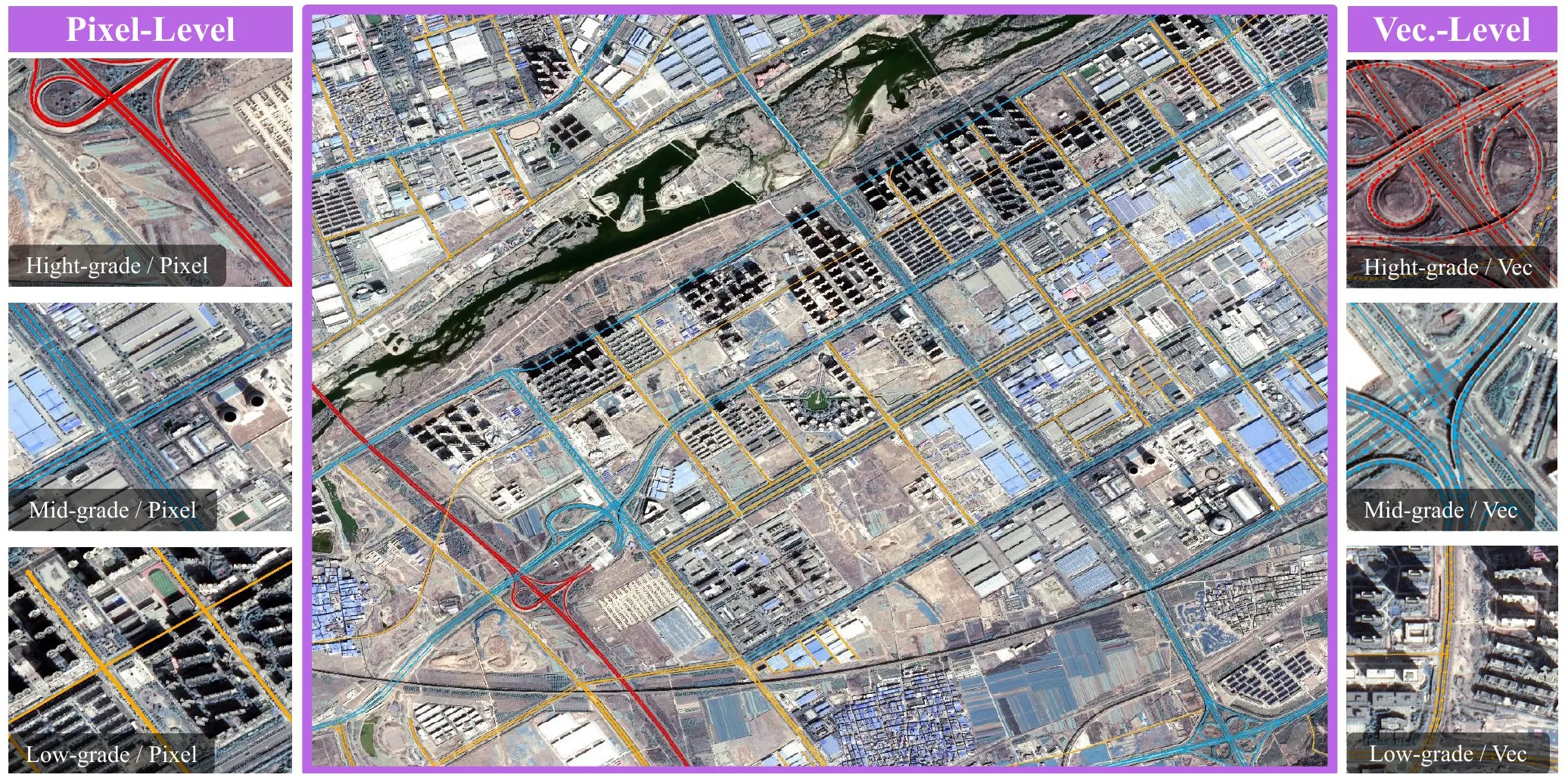
SYSU-HiRoads packages thousands of square kilometres of high-resolution satellite imagery with fine-grained road-hierarchy labels, alongside a vision-language-geometry (VLG) algorithm that classifies roads at scale. It is built for open research on transport mapping, urban planning, and disaster response.
I co-led the public release, with documentation aimed at external researchers, and authored the dissemination article that made the dataset and method accessible to the remote-sensing community. The dataset is archived on Zenodo with a citable DOI.
Fine-grained road-hierarchy annotations on remote-sensing tiles.The dataset and VLM-based method, released as an arXiv preprint.Open-science dissemination on the UNU Macau site.