The UrbanAgents interface: spatially grounded LLM agents moving through a minute-resolution model of Macau.
UrbanAgents couples high-resolution geospatial infrastructure (OpenStreetMap, points of interest, accessibility graphs) with demographically diverse populations and LLM-based decision chains. Each agent perceives its surroundings, plans, and acts, so micro-level behaviour rolls up into city-level patterns of mobility, access, and wellbeing.
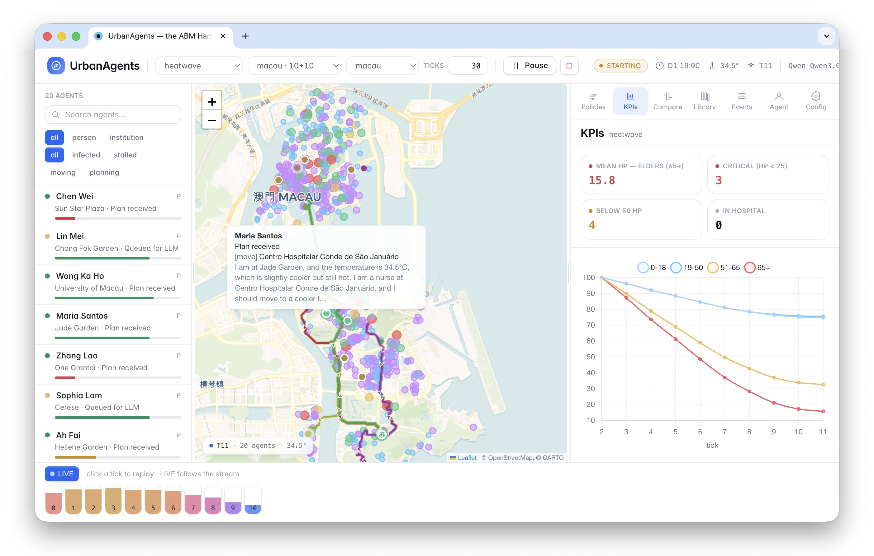
I designed scenario pipelines for the challenges that matter to dense cities: heatwave resilience, healthcare accessibility, and misinformation diffusion, all on a fifteen-minute-city accessibility model. The framework ships a React interface so the results read as policy, not just plots.